What Should I Expect During a Boundary Survey?
When considering buying or selling property, building close to property lines, or resolving disputes with neighbours, understanding your property’s boundaries is crucial. A boundary survey, conducted by a licensed professional, provides precise information about property lines, ensuring clarity and legal compliance. But what does this process entail? Here’s what you can expect during a boundary survey.
Initial Consultation
The boundary survey process begins with an initial consultation between you and the surveyor. During this phase, you’ll discuss the purpose of the survey, such as establishing property lines for a new fence, subdividing land, or clarifying boundaries for legal reasons. You’ll need to provide relevant documents like property deeds, previous surveys, and any available site plans. This meeting also helps you understand the expected costs and timeline for the survey.
Preparation and Planning
After the consultation, the surveyor conducts a thorough research phase. This includes examining property records, previous surveys, and local land use regulations. The boundary surveyor in Sydney determines the type of boundary survey required, which could range from a simple fence line survey to a more detailed subdivision survey. They then prepare the necessary equipment and set a date for the on-site survey.
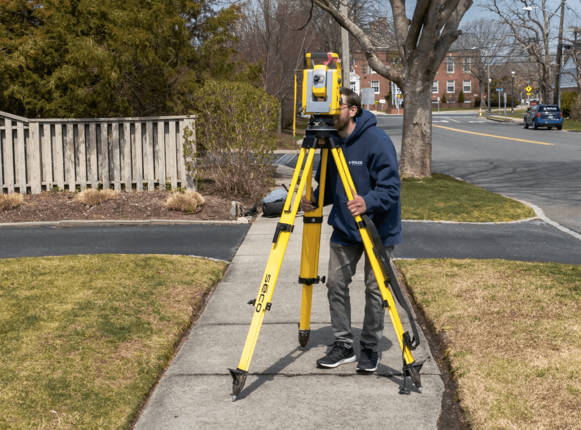
On-Site Survey Process
The on-site survey is where the actual measurement and marking of the property boundaries occur. The surveyor arrives with specialised equipment, such as total stations and GPS devices, to measure the property’s dimensions accurately. They identify and verify existing boundary markers and place new ones if needed. This step ensures that all property lines are precisely defined, using modern tools to achieve high accuracy.
Data Analysis and Mapping
Once the fieldwork is complete, the surveyor analyses the collected data to create a detailed map or plot of the property. This map includes measurements, boundary lines, and any notable features like buildings, fences, or natural landmarks. The surveyor also reviews the data for any discrepancies or encroachments, ensuring that the final report is comprehensive and accurate.
Survey Report Compilation
The final step is compiling the survey report, which provides a detailed description of the property’s boundaries and markers. This report includes precise measurements, coordinates, and notes on any easements, encroachments, or special considerations. It’s a legally recognised document that can help resolve disputes or clarify property lines for future development.
Post-Survey Consultation
After completing the report, the surveyor will review the findings with you. This post-survey consultation is an opportunity to discuss any issues discovered during the survey, such as boundary disputes or discrepancies. The surveyor can provide recommendations on resolving these issues, whether through legal action, negotiation, or physical changes to the property.
Follow-Up and Record Keeping
Finally, it’s important to keep the survey report and related documents safe for future reference. These records are invaluable for legal, sale, or development purposes. It’s also wise to consider updating the survey if significant changes are made to the property, such as new construction or land alterations.
Final Thoughts
Understanding what to expect during a boundary survey helps property owners navigate this essential process with confidence. By working with a licensed and experienced surveyor, you ensure that your property’s boundaries are clearly defined and legally compliant. Whether you’re dealing with a simple fence installation or complex land development, a boundary survey is a critical step in protecting your property interests.
Keep an eye for more news & updates on BuzzReleased!